P-wave arrival phase map (made with GMT3.x)
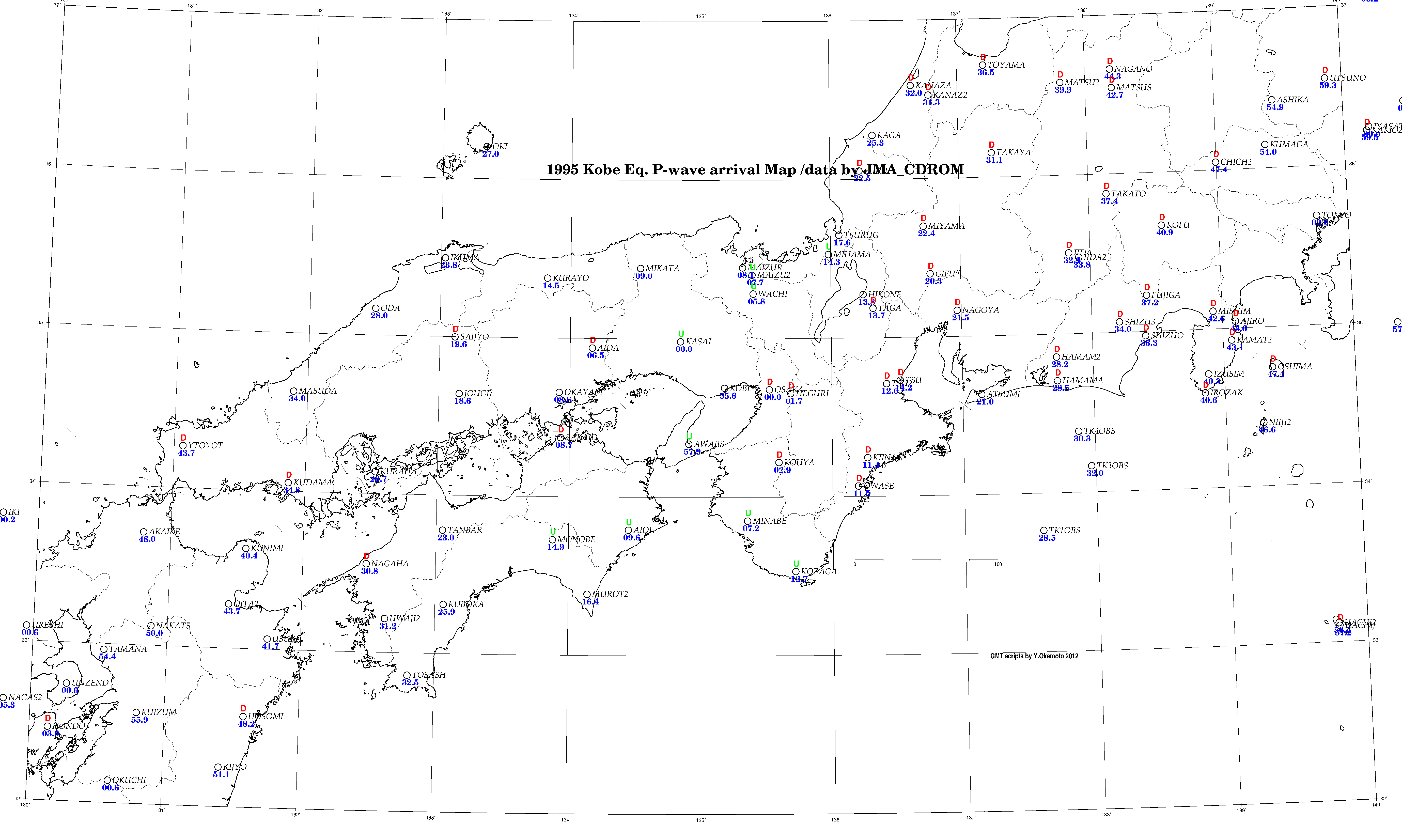
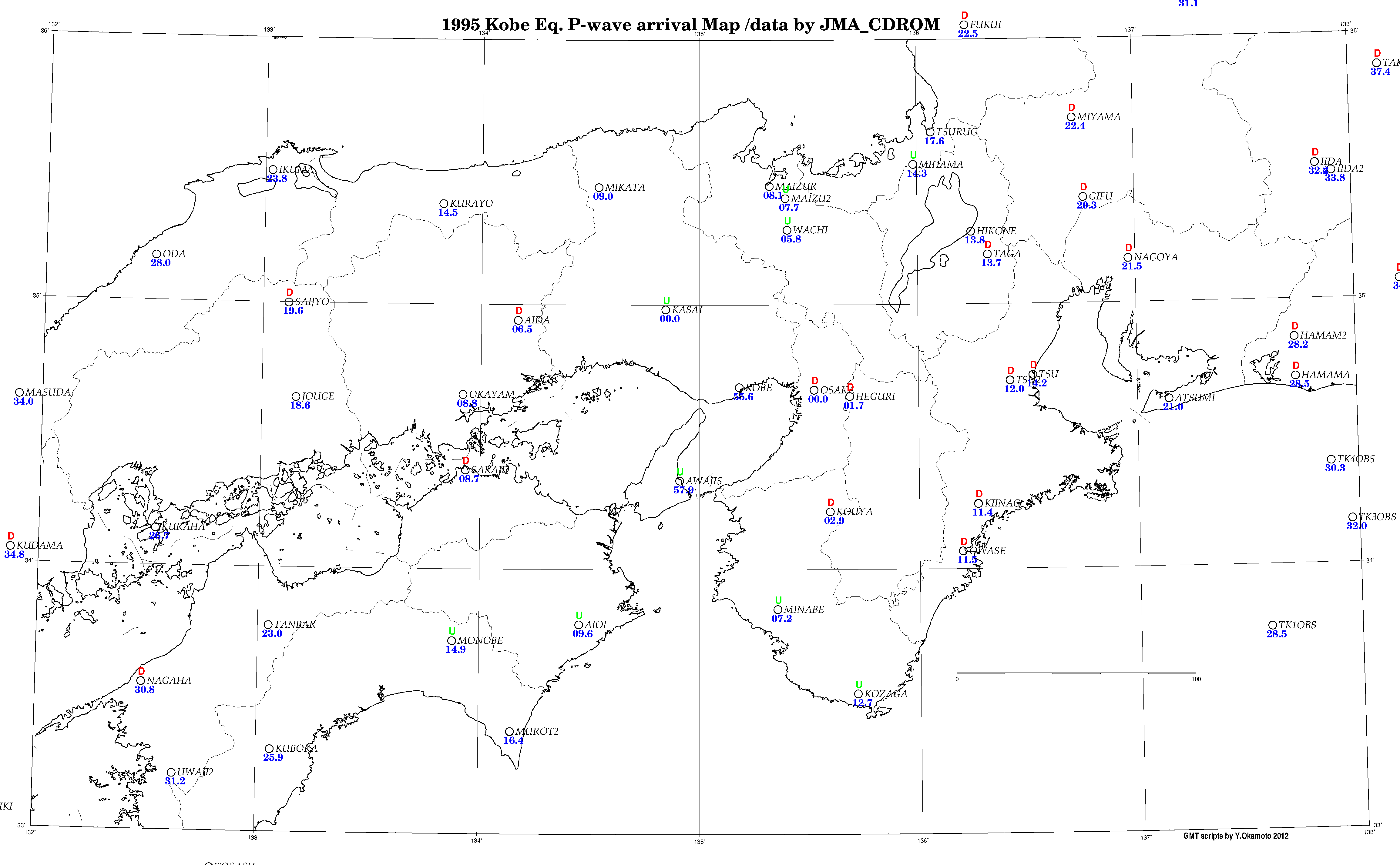
1995
年兵庫県南部地震(広域,拡大),2000
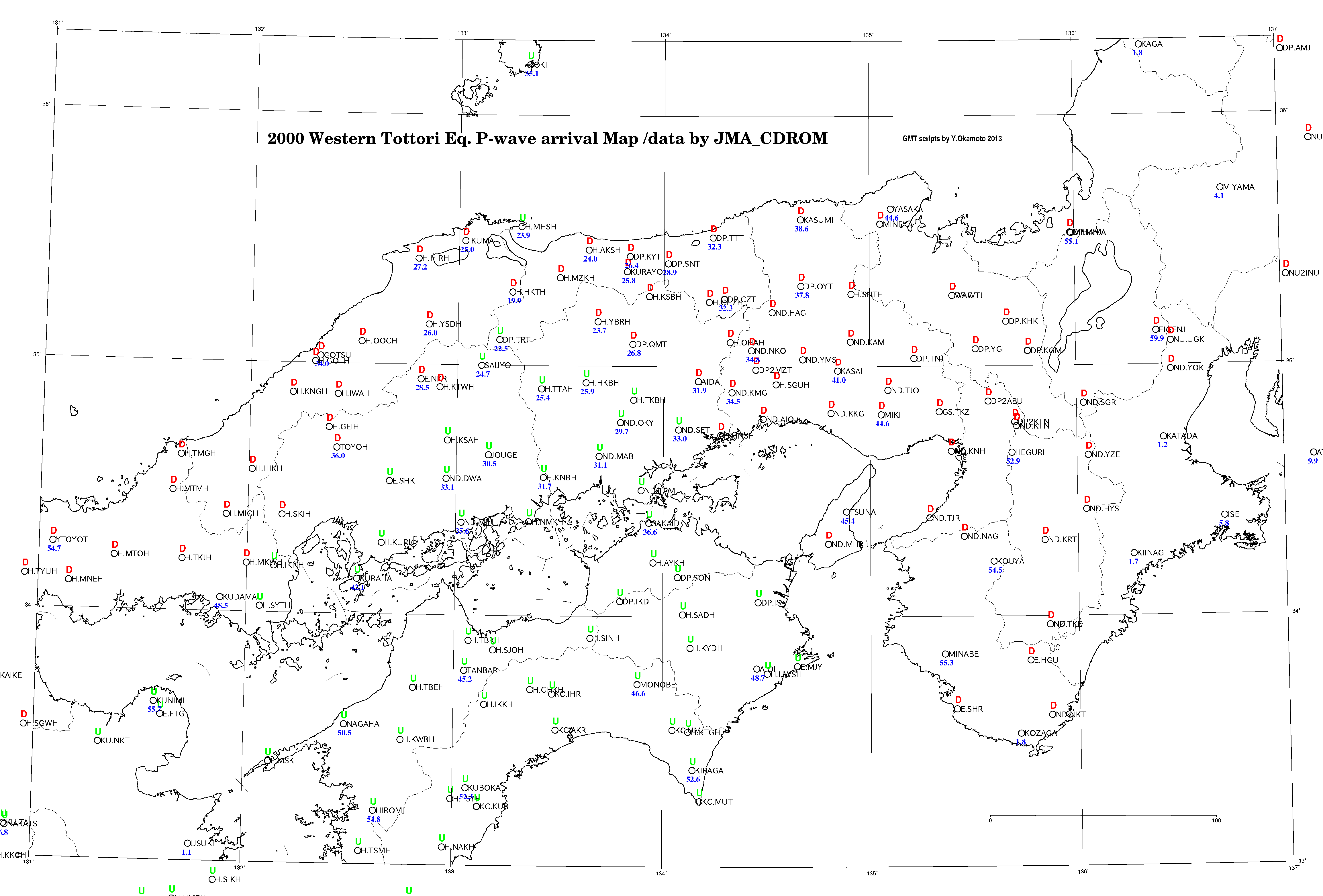
年鳥取県西部地震,2007
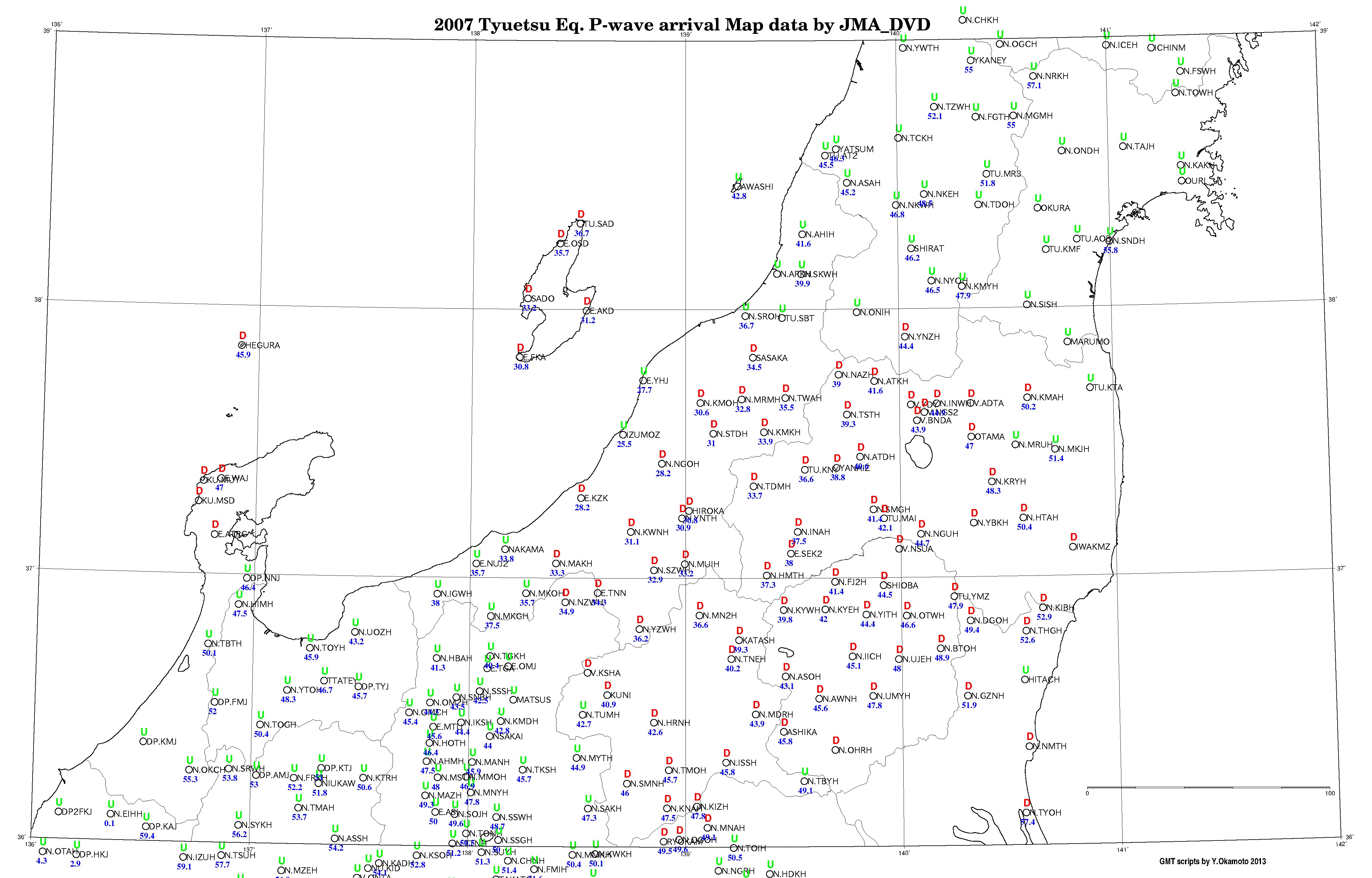
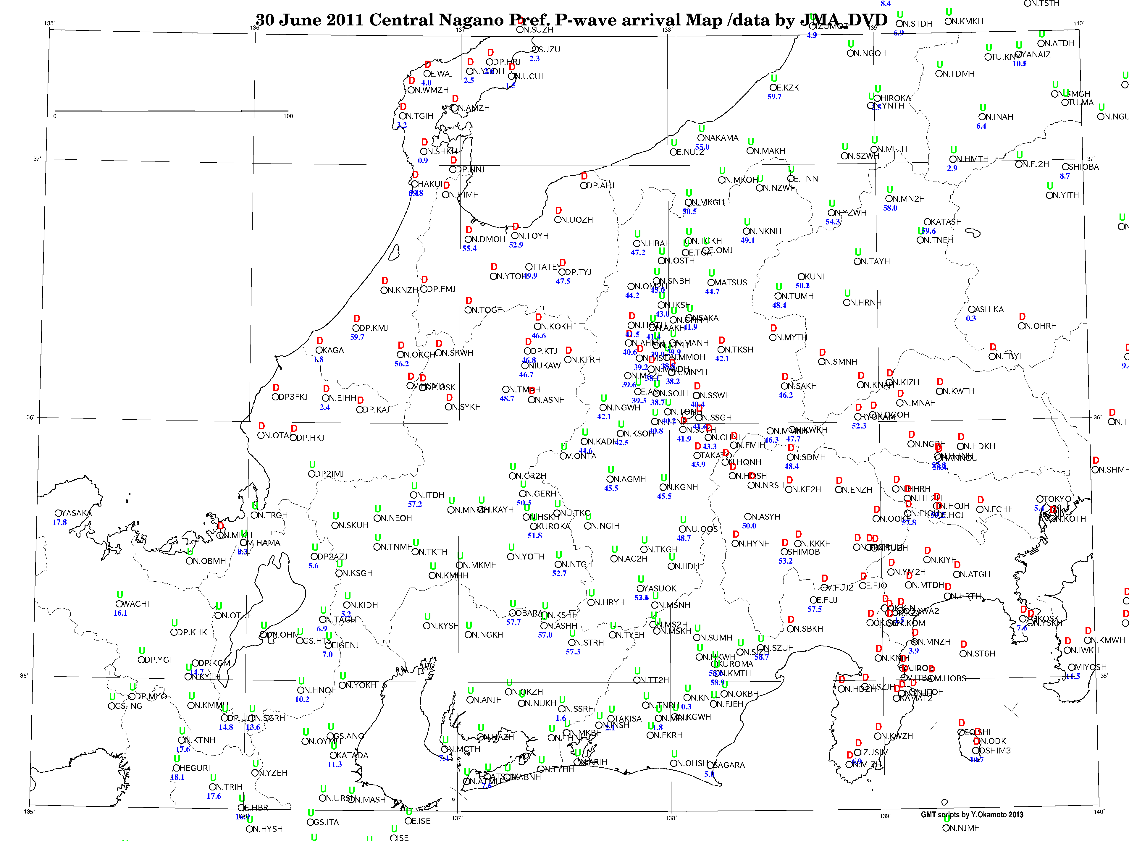
年中越地震,2011
年長野県中部,2006
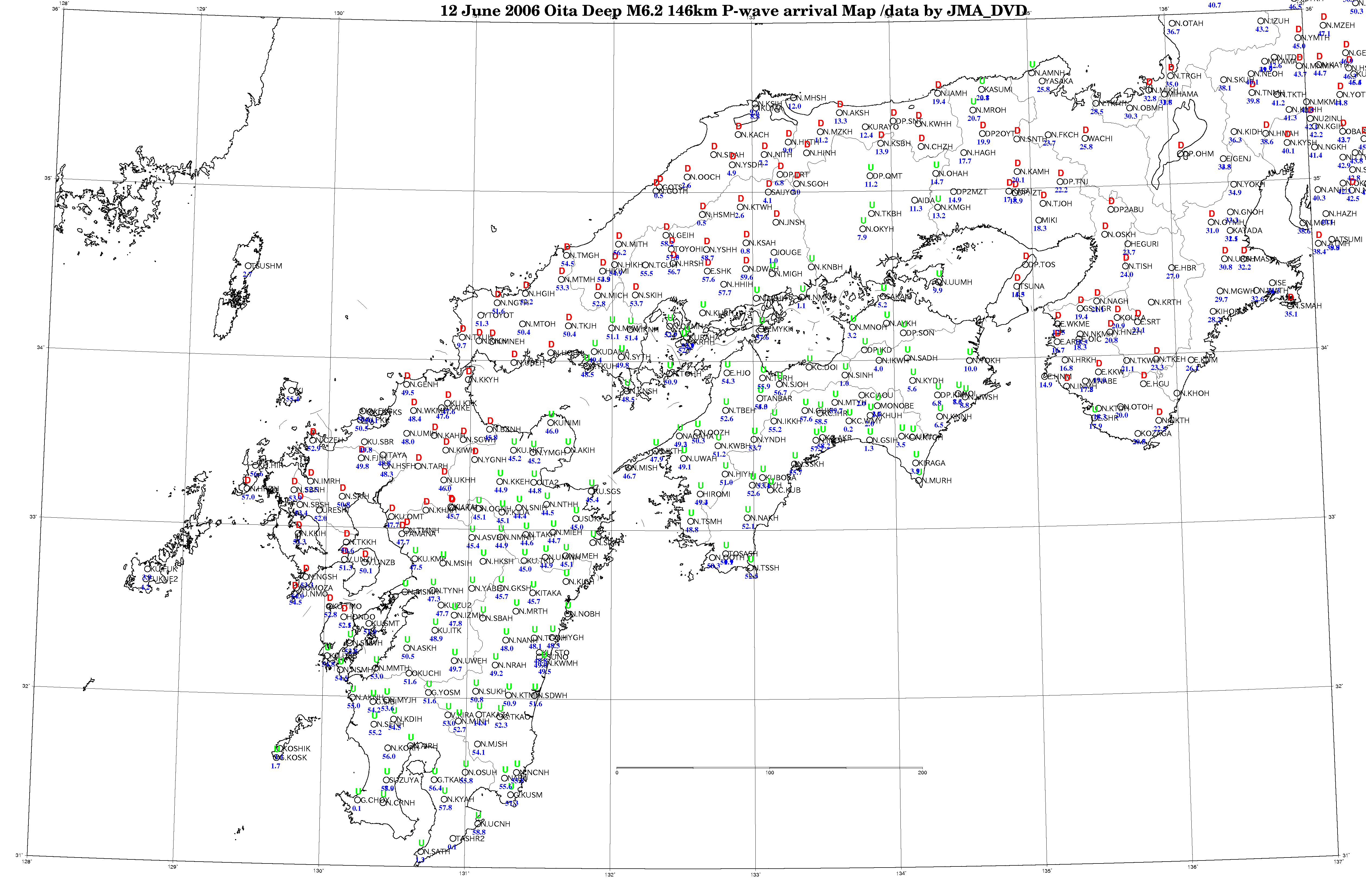
年大分やや深発,2009
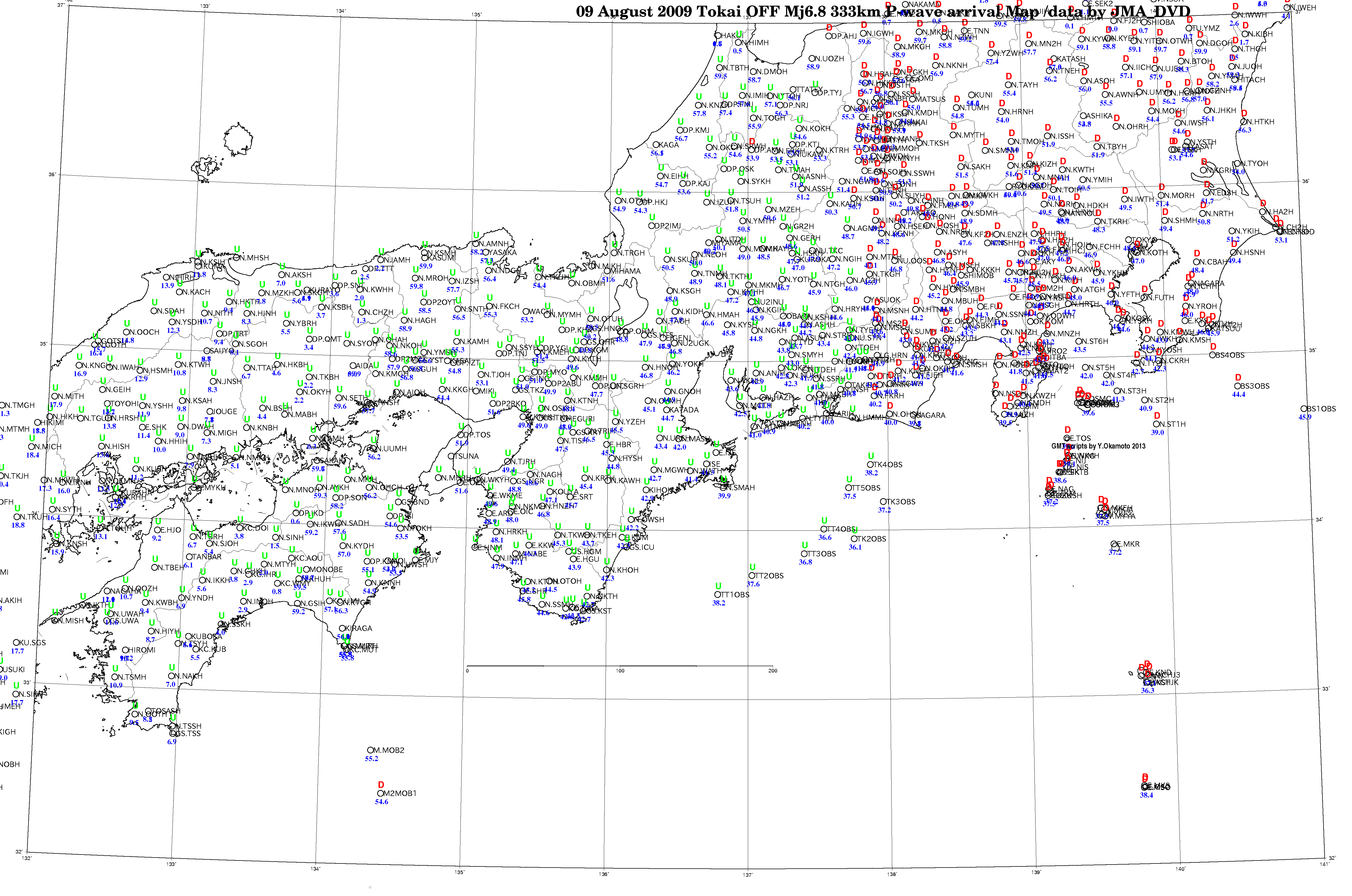
年東海沖深発,
1995 Kobe (wide, close up), 2000 Tottori, 2007 Chuetsu, 2011 Central Nagano, 2006 OOita midle depth, 2009 Tokai-Off Deep
GMT site: https://www.soest.hawaii.edu/gmt/
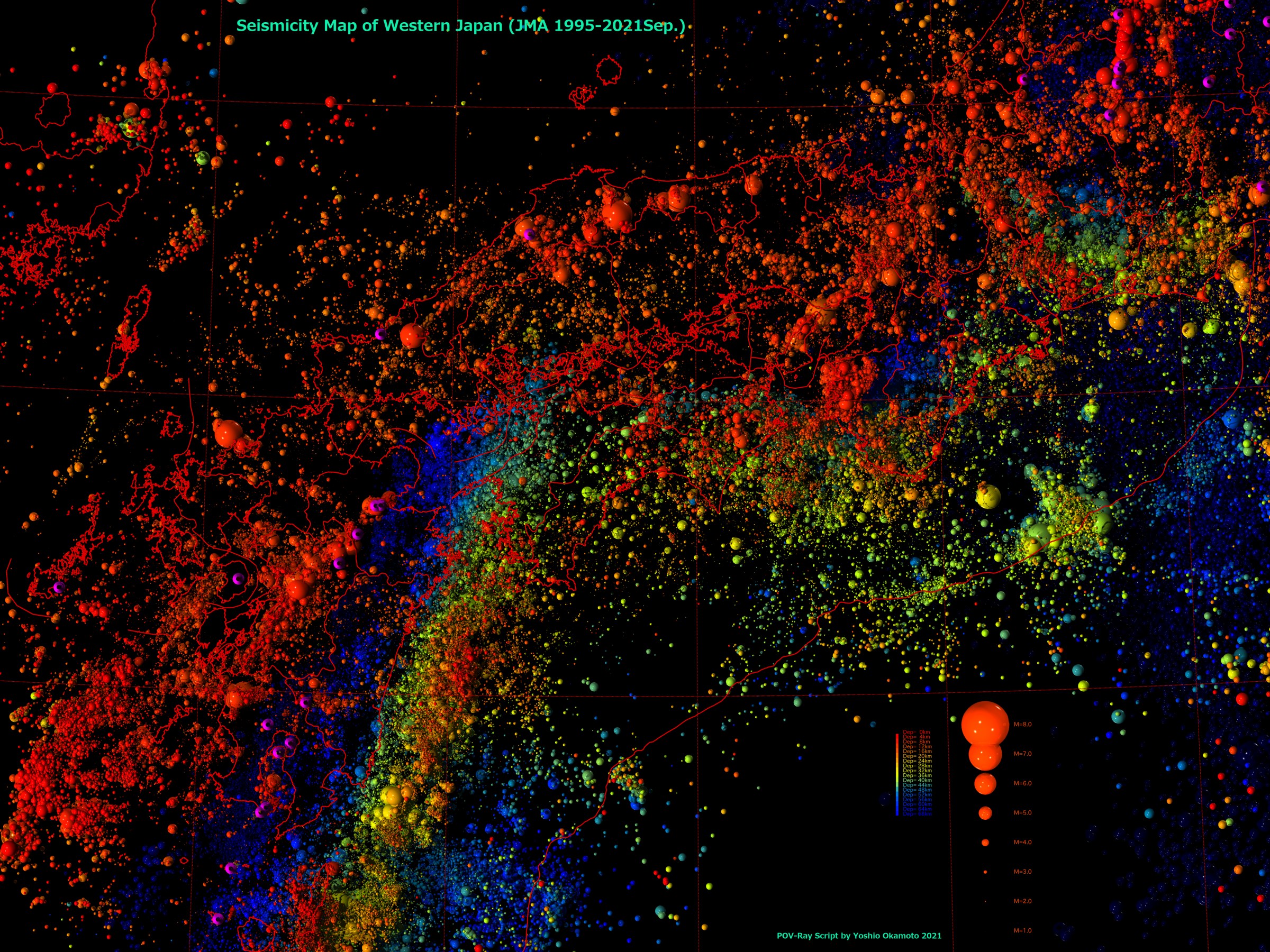
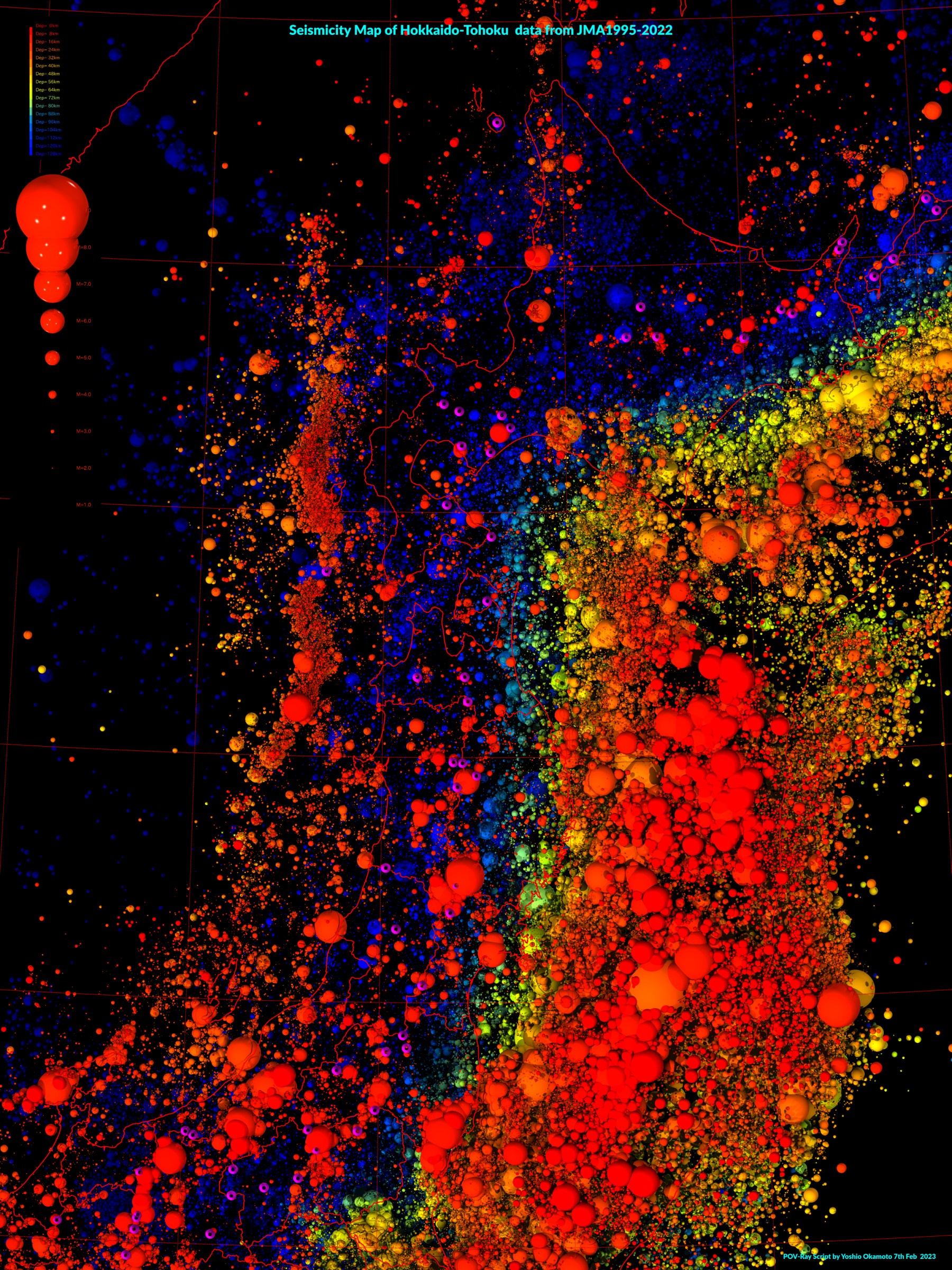
Pov-RAYによる 西日本(1995-2021Sep) 東北北海道(1995-2022) 東南アジア(工事中)
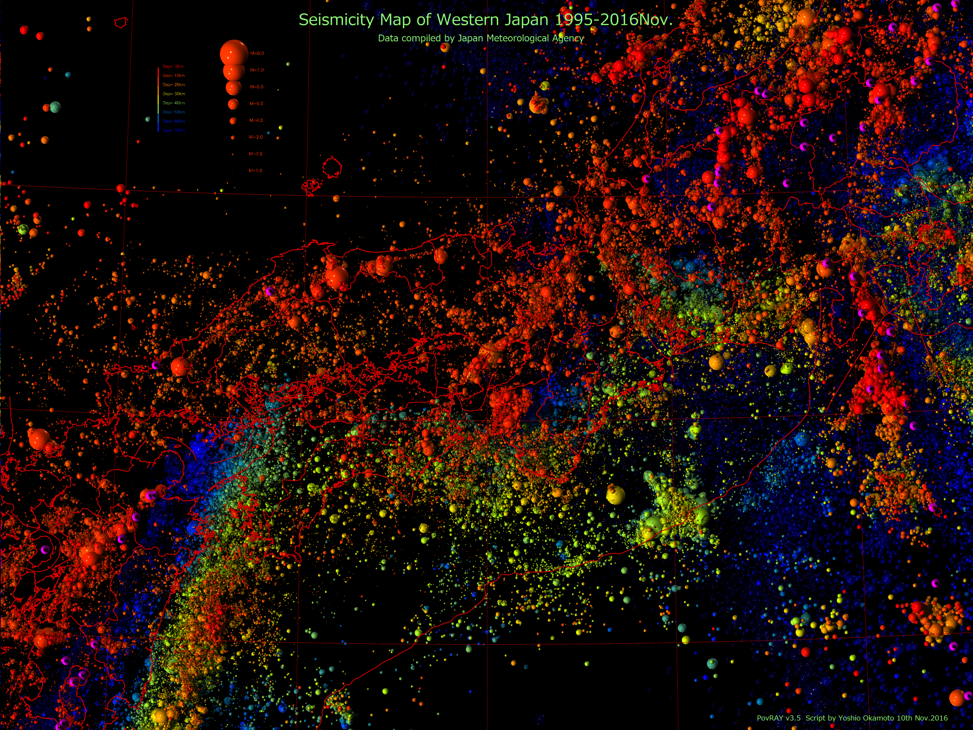
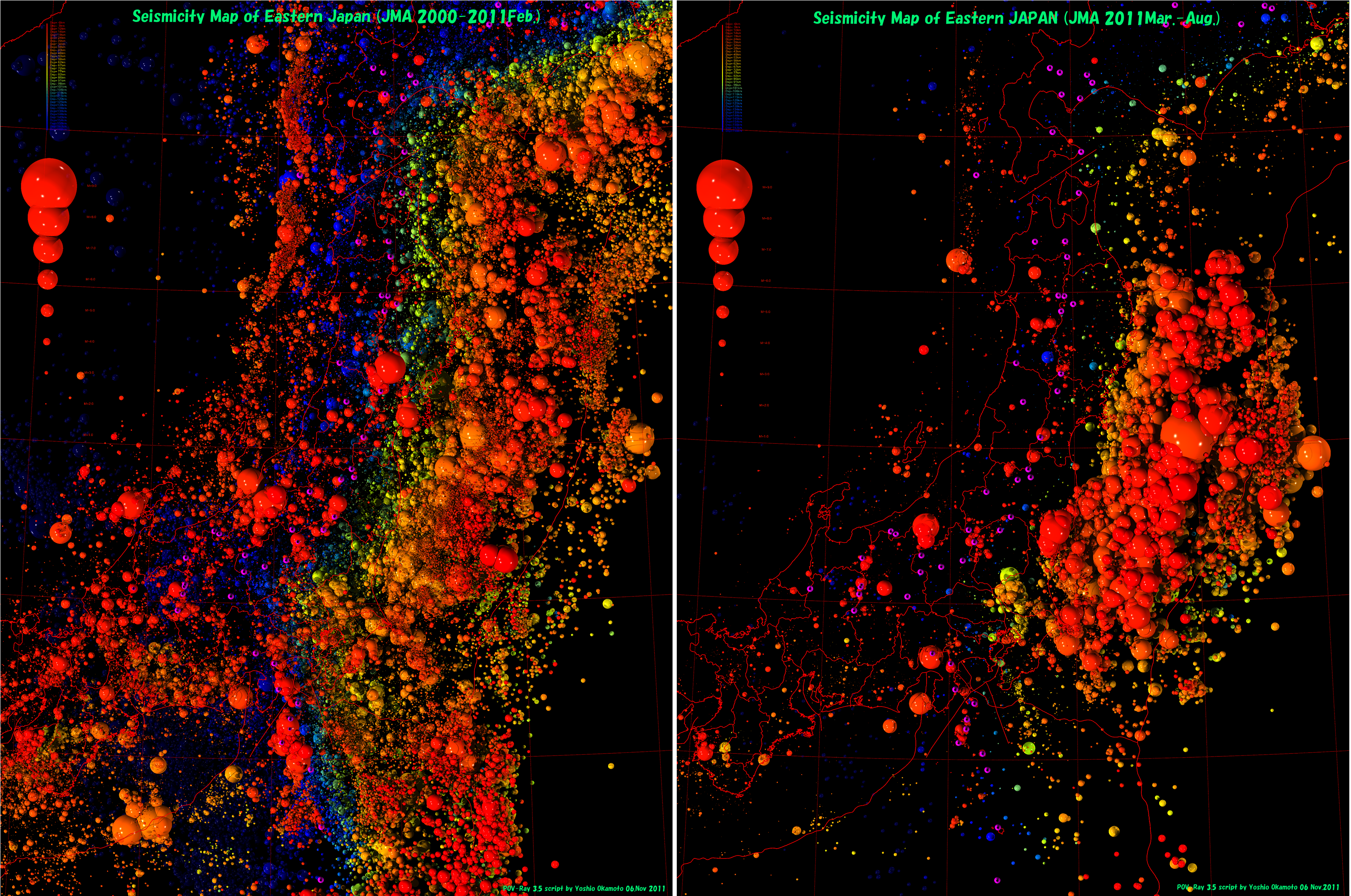
POV-Rayによる 西日本(1995-2016) 東北2011前 2011AGUPoster
<参考文献>
References
GMTによる IGC33 Oslo_Poster
with GMT Poster IGC33 Oslo_Poste
Yoshio Okamoto: Seismicity Maps for “Chroma Depth 3D Glasses”using “The
Generic Mapping Tools”,33rd IGC Oslo abstract CDROM, 2008
Yoshio Okamoto:New 3D seismicity maps using chromo-stereoscopy with two alternative freewares. 2011 AGU Fall Meeting, Abstract